Masterplan AI for Urban Planning Visualization Grand Scale
Transform site plans and urban layouts into photorealistic masterplan renders that communicate your vision for large-scale developments with clarity and impact.
No credit card required1000 free credits

Photorealistic render with perfect lighting, realistic materials and cinematic composition...
Photorealistic render with perfect lighting, realistic materials and cinematic composition...
trusted by 12000+ creators
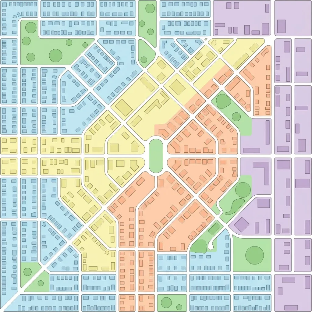
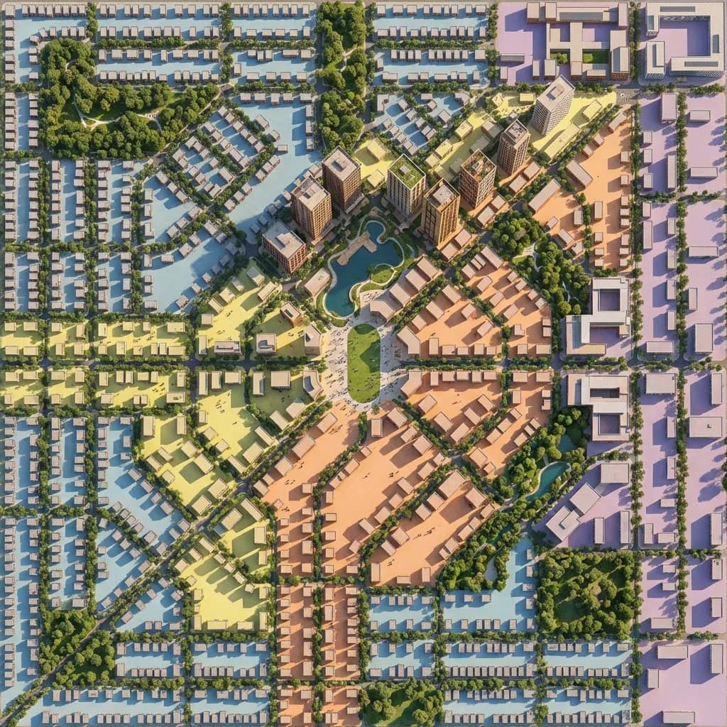
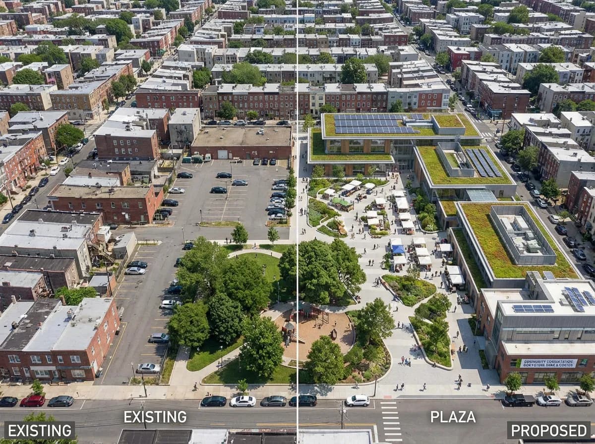
From Site Plan to Vision
Drag the slider to see how AI transforms a schematic masterplan diagram into a photorealistic aerial visualization with buildings, landscaping, and infrastructure.
How It Works
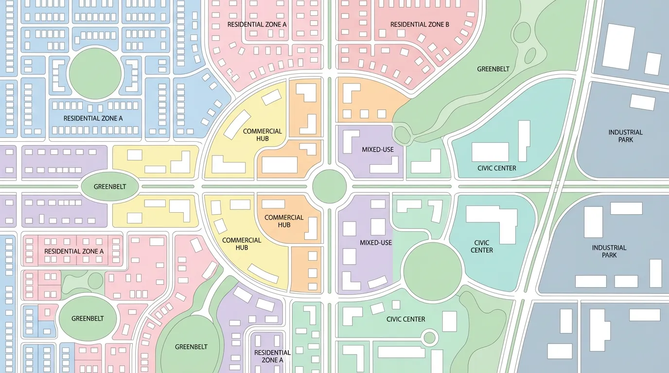
Upload a site plan, zoning diagram, CAD layout, or hand-drawn masterplan sketch. Aerial views, plan views, and diagrams all work.
Specify building typologies, landscape character, infrastructure, density, and overall aesthetic. Upload reference projects for style guidance.
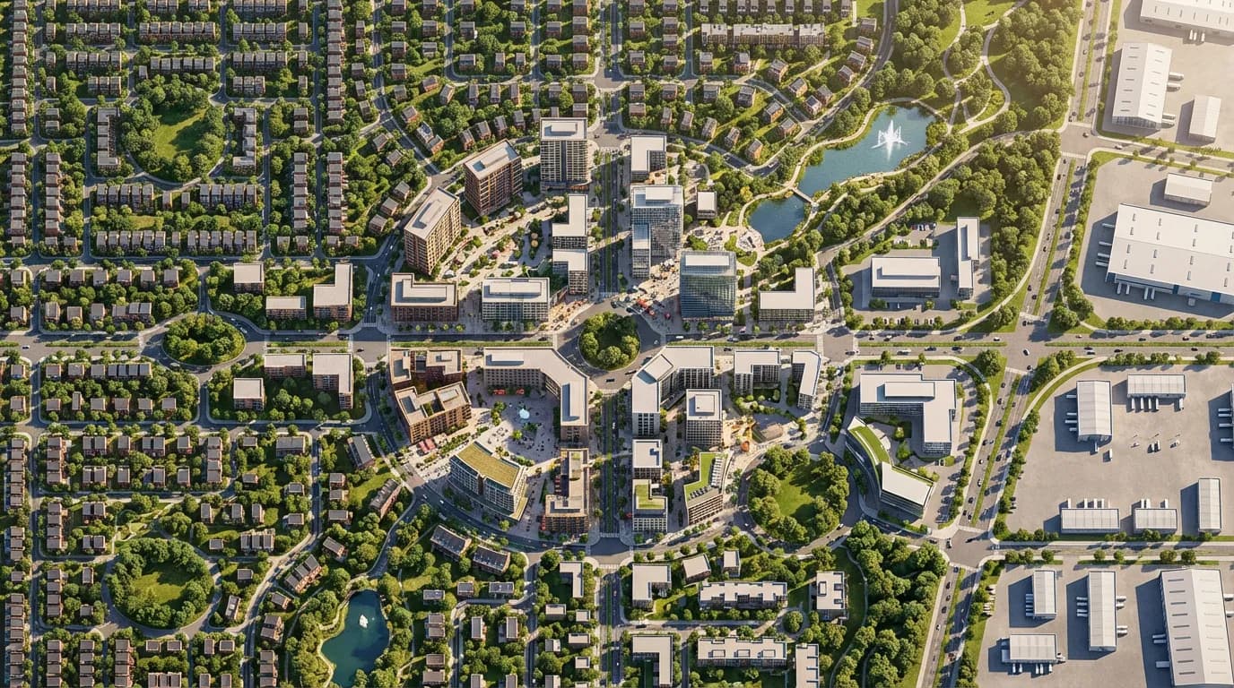
Receive a photorealistic masterplan render in seconds. Generate aerial, bird's-eye, and street-level views to tell the complete story of your development.
Built for Large-Scale Projects
From residential neighborhoods to mixed-use districts, AI masterplan rendering brings your urban vision to life at any scale.
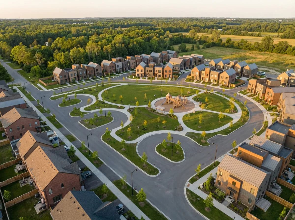
Visualize new neighborhoods, housing developments, and urban extensions with photorealistic aerial renders that show density, green spaces, and infrastructure.
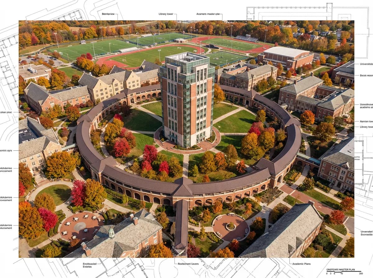
Render university campuses, hospital complexes, and corporate headquarters with building clusters, pathways, and landscaped courtyards.
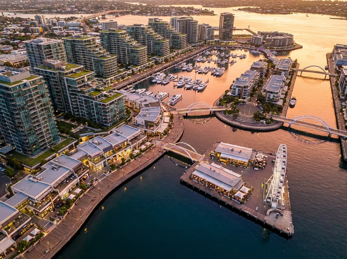
Present commercial, residential, and public spaces together in a cohesive masterplan render that shows how different functions integrate and interact.
Create accessible visual materials for community engagement and planning consultations that help non-architects understand the proposed development.
Purpose-Built for Masterplan Scale
Aerial Visualization
Generate photorealistic bird's-eye and aerial views that show the full scope of your masterplan, including building massing, road networks, and open spaces.
Landscape & Green Spaces
AI renders parks, tree-lined streets, water features, and green corridors with realistic vegetation that conveys the landscape strategy of your masterplan.
Massing & Density
Visualize building heights, plot ratios, and urban density with accurate shadow studies and scale relationships across your entire development.
Multiple Viewpoints
Generate aerial, street-level, and pedestrian views from the same masterplan to communicate the development experience at every scale.
Explore More Architecture AI
Frequently Asked Questions
Common questions about AI masterplan rendering for urban planning.